

You must log in or # to comment.
StreetComplete… Global Rank: #1567 Local Rank: #131 Days Active: 370
You’re welcome 😉
Errr global rank #5770 checking in. To be fair I’m just not out a lot.
#6002 here, working on filling up my entity village with 2k pop ✊ Also usually fill during walks on trips
#4412 here… Damn… We could hold a community meeting on Lemmy…
Every little bit helps to improve the maps for everyone else…
@Cyber Global rank of #303 on StreetComplete. I’ve been doing this for years. It’s a passion.
Nice! Ok, I’ve been doing this for a couple of years, but I think SC just shows actual number of days something was entered
But… #303… I’ve got a looong way to go
(I bet you’re a delivery driver 😉)
@Cyber Nah, I just walk around alot (especially on the weekends), and I fill in a lot of maps on the OSM iD interface.
That’s so cool they have ranks!
Yeah, you get Quests and “unlock” things - which is mostly links to sites that use OSM data for interesting things.
It’s fun for a bit, but I’m glad that after a while you don’t see them anymore…
I’m happy just recording the opening times for a decent friendly restaurant… and the name of a bustop… and house numbers… and street lighting… and…
Edit: Oh and I’ve covered 7 countries by the look of it. Canada and EU mostly…
Global rank #4997 reporting for duty 🫡
#1693 here!
I totally forgot to start doing this again. Just moved from the US to a tiny town in Sweden, I’ll play my part!
I’m glad you made it to safety!
Thank you me too! And I’m only a week in but so far I’m crushing it at school. Been having a great time here everyone is so kind and I don’t have to worry about things like getting killed for using public bathrooms!
You contribute to OSM to have an open source database free to all
I contribute to OSM so my local Pokemon GO scene has accurate biome mapping
We are not the same
What tags does pokemon go use to determine biomes? I occasionally contribute updates around my local area, that would be a neat thing to apply
Lots of them! Pokemon go has a few main biomes with lots of other factors to determine what spawns. Main biomes are grass, city, mountain, and water.
Then you have other tags for things like parks and paths, which give special spawn points. Parks have rotating habitats for one particular species and can have EX gyms. Paths will spawn Pokemon along them with a few unique species.
Regional spawns occur as well, with some continents or countries having one or more special species unique to it. And rather than a strict limit, some species are much more common in certain latitudes.
Beyond that are some tags that prevent spawns, like military bases or wetlands, places you aren’t encouraged to just walk around.
A list of tags from Reddit
Blocked Spawn areas http://overpass-turbo.eu/s/r42
Nest Locator http://overpass-turbo.eu/s/r43
Nests that require paths http://overpass-turbo.eu/s/r44
OSM Influences Nests and Blocked Spawns (a work in progress)
Nests
Confirmed
leisure=park
leisure=garden
leisure=golf_course
leisure=recreation_ground
boundary=physiogeographical
landuse=grass (may need secondary tag to be a nest)
Possible
landuse=recreation_ground
leisure=playground
landuse=village_green
leisure=pitch
boundary=national_park
Paths
highway=footpath
highway=path
highway=cycleway
highway= sidewalk
highway=footway
route=bicycle
route=hiking
route=foot
network
Creates Nests if Paths present
Confirmed
landuse=farmland
landuse=farmyard
natural=scrub
natural=heath
landuse=meadow
Possible
natural=moor*
natural=grassland
natural=fell
natural=bare_rock
natural=scree
natural=shingle
natural=sand
natural=mud
natural=valley
natural=rock
natural=stone
natural=arete
natural=beach
landuse=greenfield
(*Deprecated or incorrect tag)
Blocked Spawns
Blocks Spawns without Paths
Confirmed
natural=wood
landuse=forest
natural=forest*
Possible
landuse=orchard
(*Deprecated or incorrect tag)
Blocks all Spawns
Confirmed
landuse=construction
landuse=military
landuse=quarry
landuse=railway
landuse=landfill
aeroway=runway
aeroway=taxiway
amenity=school
highway=motorway
highway=trunk
highway=primary
highway=secondary
highway=tertiary
Water tags, unknown if surrounding spawns are water influenced
natural=wetland
wetland=
natural=glacier
natural=marsh*
(*Deprecated or incorrect tag)
Possible
amenity=daycare
amenity=kindergarten
Water
Effects biomes on edges. Blocks spawns away from land unless crossed by route=ferry?
Confirmed
landuse=basin
landuse=reservoir
natural=coastline
natural=spring
natural=water
water=lake
water=pond
water=reservoir
water=basin
water=canal
water=river
natural=waterway
waterway=river
waterway=riverbank
waterway=stream
waterway=canal
waterway=drain
waterway=ditch
man_made=water_tower
Possible
landuse=salt_pond
natural=bay
waterway=wadi
waterway=drystream
waterway=fairway
waterway=dock
waterway=boatyard
waterway=dam
waterway=weir
waterway=stream_end
waterway=waterfall
waterway=lock_gate
water=lagoon
water=reflecting_pool
water=fish_pass
water=oxbow
water=lock
water=moat
water=wastewater
water=stream_pool
Possibly Effects Biomes Only
natural=peak (Mt Moon biome forms around peaks)
landuse=industrial
landuse=commercial
landuse=residential
landuse=retail
Does not block spawns or create nests but otherwise unknown
landuse=cemetery
landuse=port
landuse=depot
landuse=garages
amenity=grave_yard
Boundaries
May influence all nests needing paths to spawn within that area
boundary=administrative
boundary=historic
boundary=maritime
boundary=political
boundary=postal_code
boundary=religious_administration
boundary=protected_area
boundary=national_park
boundary=physiogeographical
Unknown Effects
Area
natural=hot_spring
natural=volcano
natural=sinkhole
natural=tundra
landuse=brownfield
landuse=allotments
landuse=greenhouse_horticulture
landuse=plant_nursery
landuse=vineyard
geological=moraine
geological=outcrop
geological=palaeontological_site
Lines
natural=ridge
natural=cliff
natural=saddle
natural=tree_row
Nodes
natural=geyser
natural=tree
natural=cave_entrance
Some tag info from Reddit regarding paths and spawn blocking:
- Lines tagged
highway=footwaythat also carry the tagbridge=yesdo not generate additional spawn points. Critically, this encompasses all boardwalks, which are correctly taggedbridge=boardwalk. - Lines tagged
highway=footwaydo not provide a spawn point exception through the area blocked bynatural=wetlandas they do fornatural=wood. It’s possible that this is an extension of the issue withbridge=yes– I have no local examples without both tags. - Areas tagged
landuse=basinblock all spawn points, despite being used correctly to tag the contemporary practice of building a stormwater retention system beneath a city park. These areas are rendered as water in-game, but do not seem to influence Water spawns, although more data would be helpful in determining this. (OSM also has issues rendering basins.) - Areas tagged
leisure=nature_reservedo not nest. Could be intent, could be oversight, but seems like an odd exception, as the distinction between a park and a preserve is fluid – at least in the US. The same is true for areas taggedlanduse=winter_sports, the correct tag to describe a ski resort, and areas taggedleisure=dog_park. - Areas tagged
amenity=prisondo not block all spawn points. Since this is the correct way to tag a prison or jail – which is to say, a high-security facility where people probably shouldn’t be chasing Pokémon – this seems wrong. - Lines tagged
waterway=river,waterway=stream, andwaterway=ditchare not rendered on the map despite influencing Water spawns in nearby spawn points. The same is true for areas taggednatural=wetlandand points taggedamenity=fountain. - Lines tagged
power=lineandpower=minor_linedo not influence Electric spawns in the way that streams do with Water Pokémon. More of a missed opportunity than anything. You could say the same withrailway=railand Steel or any of the more specific OSM building tags the game references to seemingly no effect:leisure=stadium,amenity=cinema,tourism=hotel, and so on. - Lines tagged
highway=trackshow up visually as paths, despite being intended to represent vehicle tracks that fall short of the qualifications for being an unpaved road. They do not generate additional spawn points, so this is assumed to be an error with the in-game renderer. - Lines tagged
highway=serviceandservice=drivewayrender as roads on the map, which are not to scale. This is especially glaring if houses and garages are mapped. Ideally, there probably should be a thinner style of road for all service roads, tracks, living streets, or any other highway designation where vehicles are likely to encounter pedestrians.
Waouh. Gather such knowledge is some dedication to a game. Congrats!
The Silph Road community goes hard lol
The Pokémon community in general goes hard, and I absolutely love that part about it!
(to clarify: not the modern games, but the community)
- Lines tagged
My kind of heroes. People who seek to better the world without seeking attention while doing it.
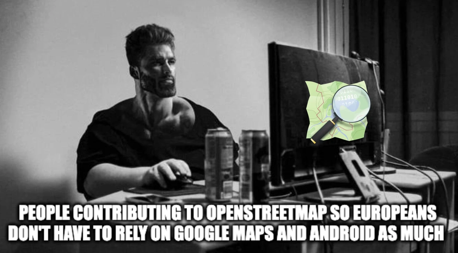
And there’s an app to help contributing to openstreetmap.
Here’s a link to it on f-droid…
Also OpenDoor. Doesn’t look as pretty but you if you read a bit about tags on the osm wiki you can add and edit a lot in this app
Oh, cool. Need to check it. I never heard of it before.
OpenDoor. Noted. Thanks.
They were thinking of EveryDoor. There’s also MapComplete, a bit more niche- focused on deep diving in specific themes without having to learn all the specific tagging for that topic.
How does this compare to OsmAnd, which is what I currently use?
Isn’t OsmAnd primarily a navigation app?
StreetComplete is an app that gives you tasks to complete, like “Does the bus stop have a light? Can blind people use the cross walk? What’s the house number? How many bikes can use the bike parking lot?”
It’s a bit like Pokemon Go, but without a for profit company behind it and the result helps other people.
Try it out… It’s free.
Can recc Street Complete as well, so much fun. I do use Osmand to add cafes or websites to places, works quite ok for that as well.
Well, I am convinced. Thanks for explaining the difference. I usually use the app for navigation and then add spots that I see are missing when I get home on the website.
Can someone please TLDR/ELI5 how one contributes to this and what the end ‘service’ looks like?
I’d suggest EveryDoor instead of streetcomplete as it focuses more on points of intrests
The only thing it’s missing is live traffic, I would switch in a heartbeat. It’s my main goto for biking and walking, just not the car for that reason.
Question: how does one not doxx them selves when mapping their local area? Or is it not an issue because you don’t really provide any info past that?
To properly link your mapping to your identity, someone would both need to be able to link whatever online username you’re using to the one in street complete. Which could be either easy or very hard depending on how correlated they are (same username maybe?)
And even then the accuracy will probably not be great, maybe up to the city. Any more specific than that will be hard unless the edits are very obviously centered around a street.
TLDR: probably not too bad of an issue
Best thing: map little bits of any area you’re in and then you’re not pin pointing yourself.
But as someone else pointed out, you don’t have to upload at the time you’re doing the clarifications, so it’s very low risk of someone working out where you are.
I just use a unique username for it
You can just search me up and get my city easily, so my open street contribution won’t help that much in narrowing it down. Honestly the public records are enough that people can just follow me around from work, probably.
You can disable auto-upload. I collect 50 or 100 tasks and upload them at once. So, it’s at least not possible to know where I currently am, just where I was a few days or weeks ago.
I kind of completed tasks in a larger area. But which city I’m living in is kind of obvious if you look at my OSM account.
So, it’s at least not possible to know where I currently am, just where I was a few days or weeks ago.
Some OSM edits add the date of the survey though, so it’s possible to know when you were at a place and e.g. confirmed its opening hours. But honestly no one’s gonna doxx you or whatever lol
What is desperately needed by all the open source navigation apps on Android is traffic info. You just can’t plan a half decent route without it. Speed limits info is not enough to know the time a route will take. You need the actural average speed of the roads. Especially on old European roads.
Can people not scrape other platforms and train their
AIopenstreetmaps on publicly available informationDoubt it. OSM doesn’t allow contributors to rip from Google and alike, scraping would be included in that presumably. Google has the copyright here.
How would Google realistically prevent it from happening slowly organically from real people who happen to look it up
If incorrect data gets copied thats quite a good indicator that we are copying google.
If it’s one person, maybe google doesn’t care, but frankly I think we should want to get the data in such a way that google doesn’t even get to make a noise about it.
Traffic isn’t like that. Sure there are patterns and constants, but there is accidents and road closures, etc.
But how to do that reliably and with up-to-date info if not invading the privacy of people?
Legally forced sharing from all platforms with onion routing and no ID? Government road data fed by all those cameras? Seams a solvable problem if done with privacy in mind not as yet another opportunity for mass surveillance.
To be fair, we all did just fine before Waze existed.
Nope. I was frequently late when using any number of open sat navs without traffic info. I end up reverting to close Waze or Google Maps.
Yeah, it’s hard to overstate what a big deal real-time traffic data was/is. And I have to wonder, how many traffic jams are prevented - or at least reduced - by it. How did we manage before Waze et al.? We were just late a lot more.
How did we manage before Waze et al.?
I (and i suspect most people who cared to know) listened to a local radio station who reported on traffic during high (or abnormal) traffic periods of the day.
As far as I know HERE WeGo app is based on OSM and also includes life traffic info
You’re welcome 😌
CoMaps and OrganicMaps are really cool and integrate with OpenStreetMap to edit places and stuff.
If only the apps with navigation weren’t total ass though…
Yeah, that’s my biggest gripe too. It’s awesome for outdoor stuff like hikes and bike rides. But actually just typing in an address/POI like in Google Maps and it finds it? Somehow it doesn’t work. At least with OsmAnd and OrganicMaps.
IIRC that works better with MagicEarth. Of course, GoogleMaps still does have better POI and address coverage in many places, and they can train their search on billions of users.
In the UK we usually just type in the post code and that’s enough to get you within visual range of the place you’re looking for. The map has some built in post codes but not all of them, but I discovered you can import a complete dataset into osmand as points of interest which improves the post code search massively.
The repository with the tools to build the postcode POI file is here: https://github.com/hvdwolf/OsmAnd-UKpostcodes/
But you can also download a pre-built one from here: https://github.com/hvdwolf/OsmAnd-UKpostcodes/releases/download/202102/UK_postcodes_poi_europe.obf.zip
It took me too long to realize that OsmAnd has separate POI and address searches. Street numbers are often missing though
Without traffic info for average road speeds and any jams, navigation can’t be good.
Really ☄️wish☄️ comaps was available on accrescent instead of organicmaps
I don’t get how a map can be copyrighted.
Like if two people happens to draw the same exact map, then what? Who gets to sue who? First come first serve? Literally does not make sense.
“Intellectual Property” doesn’t make sense for something like a map, like… its not a manuscript/draft of a book where its secret and hidden, the streets are literally public for anyone to draw, like wtf is a copyright for?!?
(I wanna just “pirate” all of Google’s Maps lol)
Like if two people happens to draw the same exact map, then what? Who gets to sue who? First come first serve? Literally does not make sense.
In many cases intention matters. Two people can take the same picture and that would be fine, but if the intention was to copy someone’s work, then this is bad.
Also, in this case often the person accused of copying someone, needs to proof that they didn’t, which inverts the burden of proof. Copyright as it works right now, serves more the wealthy then the little men, as it is with so many laws under the current system.
Copyright itself needs to be reorganized fundamentally.
Also, in this case often the person accused of copying someone, needs to proof that they didn’t, which inverts the burden of proof.
I’m not sure that that claim is accurate.
To my knowledge it is not usually the case that someone who is sued for copyright infringement needs to prove their innocence before the court. Normally it is the accuser who needs to prove beyond reasonable doubt that the copyright infringement took place.
Could it be that you might be conflating it with YouTube and their ContentID system?
That system is not strictly a legal requirement, but rather YouTube covering their ass so they don’t get sued into oblivion for the many cases of copyright infringement that people upload to that platform on the regularEdit: However, I do agree that the copyright system needs a pretty significant overhaul to better suit the digital age.
The DMCA takedowns work like that, AFAIK.
Under the DMCA a copyright holder can send out a take-down notice.
This is essentially the copyright holder telling you that they believe you to be in violation of their copyright. They are requesting you take down the content they believe to be infringing on their copyright, backed up by the threat of legal action.
The take-down notice is not forcing you to take down the allegedly infringing work. You have the option to send back a counter-notice, saying that you believe no copyright infringement took place. However, then the copyright holder might take you to court to determine whether this is a case of copyright infringement or not.
When the case is taken to court it is still up to the copyright holder to prove beyond reasonable doubt that this is a case of copyright infringement.
(I’m not a lawyer, but this is my understanding of how the DMCA works)
Think of it like this: what happens if two artists paint the same sunset? It’s the results of their efforts that is protected, not the inspiration.
Mapping accurately is an incredibly time-intensive process.
A person or company that puts in the time and effort to accurately map an area and sell the resulting product deserves to get compensated for that time spent, in my opinion. And if someone comes in to take their work, copy it and sell it as their own, then that could justifiably be called copyright infringement or theft.
Just like how a painting of a church can be copyrighted (while the building is not), or how a dictionary can be copyrighted (while the words are not), a map can be copyrighted while the features that it depicts are not.
like wtf is a copyright for?!?
The copyright is for the time and effort spent to accurately map a region.
It’s also much higher quality than Google Maps.
As a resident of Salt Lake City, host of the 2034 winter Olympics, I want to wow the Europeans that visit. We will not be limited by our national politics. I will continue to throw my time into OSM because I believe it will change the world beyond it’s ambitions. I’m stuck on the idea of a community map.
I hate to break it to you, but nobody is going to come lol


